SUMMARY OF THE MAIN RESOURCES AND FEATURES OF THIS PAGE:
--Custom maps of snow depth for the region right on this page
--Custom maps of snowfall in the last 24, 48, and 72 hours for the region right on this page
--Links to interactive snow on the ground now maps for many areas in the region
--Links to interactive snow on the ground now maps for all around the USA
--Links to interactive snowfall in the last 24 hours maps for many areas in the region
--Recent snowfall maps from the National Climatic Data Center
--Daily snowfall and snow depth logs maintained by local expers on local websites
--Seasonal snowfall maps for 2002-2003 through 2008-2009
--Snowfall by month and year since 1890 on a spreadsheet
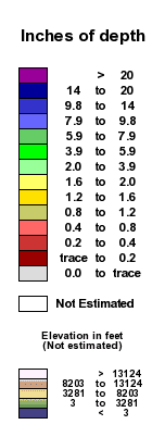
NOTE ABOUT THE SNOW DEPTH SCALES
There are two snow depth scales and two corresponding snow depth maps.
The "fine and shallow" scale has the advantage of greater discrimination for depths less than two feet. But there is no discrimination at all for depths greater than two feet since the highest the scale goes is 24 inches or more. With this scale and map, for example, you can't really tell whether a particular spot has, say, 28 inches on the ground or 32 inches on the ground.
The "full and deep" scale has the advantage that it discriminates for snow depths greater than 24 inches. In fact, the highest range of snow depth shown has a low bound of 100 inches and a high bound of 150 inches, so therefore this scale is useful not only for Big Snow Country but even for the snowiest, highest mountains of the Rockies and the Pacific coast range, where snow piles up the highest. The disadvantage of the full and deep scale is that for snow depths less than 24 inches, there is less discrimination. It is much more difficult to tell, for example, whether a particular location has 14 inches on the ground or 12 inches on the ground.
For Big Snow Country both scales and both corresponding maps are shown. For the links to the other regional snow depth maps, the link goes to either one scale/map combination or the other one depending on which is most appropriate and useful. For a very small number of regions, links are provided to both maps and scales.
CURRENT SNOW DEPTHS, FULL / DEEP SCALE, WEST AND CENTRAL
CURRENT SNOW DEPTHS, FINE / SHALLOW SCALE, WEST AND CENTRAL
CURRENT SNOW DEPTHS, FULL / DEEP SCALE, CENTRAL AND EAST
CURRENT SNOW DEPTHS, FINE / SHALLOW SCALE, CENTRAL AND EAST
SNOWFALL IN THE LAST 24 HOURS WEST AND CENTRAL
SNOWFALL IN THE LAST 48 HOURS WEST AND CENTRAL
SNOWFALL IN THE LAST 72 HOURS WEST AND CENTRAL
SNOWFALL IN THE LAST 24 HOURS-CENTRAL AND EAST
SNOWFALL IN THE LAST 48 HOURS CENTRAL AND EAST
SNOWFALL IN THE LAST 72 HOURS CENTRAL AND EAST
CURRENT SNOW ON THE GROUND AT DOZENS OF LOCATIONS
NOTE: the following link leads you to a listing of the snow on the ground at many stations as of the first of the current month. To update to the current day, look for "dd=1" in your browser address bar, which you will find about 3/4 of the way from the start to the finish of the address, and change the number "1" to whatever the current day of the month it is.
--Inches of snow on the ground now by station for dozens of towns and uninhabited locations
INTERACTIVE MAPS OF AMOUNT OF SNOW ON THE GROUND NOW
--Western Big Snow Country: Gobegic County and Ontonagon County in MI, and Vilas and Iron Counties in WI interactive snow map
--Ontonagon, Houghton, and Baraga Counties interactive snow map
--Keweenaw County interactive snow map
--Houghton County interactive snow map
--South Range Highway 26 Corridor interactive snow map
--Ontonagon County interactive snow map
--Baraga County interactive snow map
--Marquette County interactive snow map
--Alger, Delta, and Schoolcraft Counties interactive snow map
--Eastern Big Snow Country: Alger, Schoolcraft, Luce, Chippewa, and Mackinac Counties interactive snow map
REGIONAL VIEW INTERACTIVE MAPS OF SNOW ON THE GROUND NOW
--Western Big Snow Country, northwestern Wisconsin, Duluth Minnesota area, and Twin Cities interactive snow map
--Upper Peninsula, most of Wisconsin, and most of Michigan interactive snow map
WIDE REGIONAL VIEWS INTERACTIVE MAPS OF SNOW ON THE GROUND NOW
--Western Great Lakes interactive snow map
--Wisconsin & vicinity interactive snow map--Full & High Scale
--Wisconsin & vicinity interactive snow map--Fine & Shallow Scale
--Lower Michigan, Eastern Wisconsin, & vicinity interactive snow map
--Great Lakes area interactive snow map
SIMPLE NUMERICAL SNOW MAP OF SNOW ON THE GROUND NOW
--Big Snow Country Map showing number of inches of snow on the ground at observer stations
CURRENT SNOW DEPTHS ACCORDING TO THE NATIONAL CLIMATIC DATA CENTER
--Current Michigan snow depths
--Current Wisconsin snow depths

DAILY SNOW LOGS MAINTAINED BY LOCAL EXPERTS
OUTSTANDING HOUGHTON AND KEWEENAW COUNTY RECORDS HERE>>>
--Michigan Tech University Keweenaw Research Center Daily Snow Log for snowfall near the Houghton Airport
--Daily snow depth and recent snowfall log for southern Keweenaw County about 20 miles north of Houghton. Also, 2006-09 monthly snow records for southern Keweenaw county. Also, 2000-2006 monthly snow records for Lake Linden, about 11 miles northeast of Houghton in northeastern Houghton County. Also, 1953-2000 monthly snow records for the Houghton County Airport, about 5 miles northeast of Houghton
COLOR CONTOUR SEASONAL SNOW MAPS

SNOW ON THE GROUND NOW ELSEWHERE IN THE USA
WESTERN MIDWEST INTERACTIVE SNOW ON THE GROUND NOW MAPS
--Minnesota and vicinity interactive snow map
--Iowa and vicinity interactive snow map
--North Dakota and vicinity interactive snow map
--South Dakota and vicinity interactive snow map
--High Plains interactive snow map
--Missouri, southern Iowa, western Illinois, northern Arkansas, northeastern Oklahoma, eastern Kansas, & southeastern Nebraska interactive snow map
ROCKY MOUNTAINS INTERACTIVE SNOW ON THE GROUND NOW MAPS
--Montana and vicinity interactive snow map
--Wyoming and vicinity interactive snow map
--Colorado and vicinity interactive snow map
--Southern Idaho, western Wyoming, northern Utah, and northeastern Nevada interactive snow map
PACIFIC STATES INTERACTIVE SNOW ON THE GROUND NOW MAPS
--Northern California and western Nevada interactive snow map
--Oregon and vicinity interactive snow map
--Washington and vicinity interactive snow map
NORTHEASTERN INTERACTIVE SNOW ON THE GROUND NOW MAPS
--Maine and vicinity interactive snow map
--New England and New York City area interactive snow map
--Lake Ontario and Lake Erie snow belt areas interactive snow map
--Pennsylvania, New Jersey, Delaware, Maryland, & Virginia interactive snow map
--Indiana, Ohio, western Pennsylvania, West Virginia, western Virginia, and Kentucky interactive snow map
SOUTHERN US WIDE REGIONAL INTERACTIVE SNOW ON THE GROUND NOW MAPS
--Southwestern US interactive snow map
--South central US interactive snow map
--Southeastern US interactive snow map
ENTIRE COUNTRY INTERACTIVE SNOW ON THE GROUND NOW MAP
--Entire country interactive snow map

SNOWFALL IN THE LAST 24 LOCATIONS FOR DOZENS OF LOCATIONS
NOTE: the following link leads you to a listing of the snowfall in the last 24 hours at many stations on the first day of the current month. To update to the current day, look for "dd=1" in your browser address bar, which you will find about 3/4 of the way from the start to the finish of the long address, and change the number "1" to whatever the current day of the month it is.
--Inches of snow that have fallen in the last 24 hours for dozens of towns and uninhabited locations
SNOWFALL IN THE LAST 24 HOURS INTERACTIVE MAPS
INTERACTIVE MAPS OF SNOWFALL IN THE LAST 24 HOURS
NOTE: The maps that you will see when you click any of the links that follow are close to but not exactly up to the current hour. They show snowfall for the number of hours indicated ending about 1-7 hours before the time you are looking at them. More specifically, the period shown is the time period ending at 6 am, 12 noon, 6 pm, or 12 midnight, whichever is the most recent time.
--Western Big Snow Country: Gobegic County and Ontonagon County in MI, and Vilas and Iron Counties in WI interactive snow map
--Ontonagon, Houghton, and Baraga Counties interactive snow map
--Keweenaw County interactive snow map
--Houghton County interactive snow map
--South Range Highway 26 Corridor interactive snow map
--Ontonagon County interactive snow map
--Baraga County interactive snow map
--Marquette County interactive snow map
--Alger, Delta, and Schoolcraft Counties interactive snow map
--Luce County and Western Chippewa County interactive snow map
--Eastern Big Snow Country: Alger, Schoolcraft, Luce, Chippewa, and Mackinac Counties interactive snow map
REGIONAL VIEWS INTERACTIVE MAPS OF SNOWFALL IN THE LAST 24 HOURS
--Western Big Snow Country, northwestern Wisconsin, Duluth Minnesota area, and the Twin Cities area interactive snow map
--Upper Peninsula, northern Wisconsin, and northwestern Lower Peninsula interactive snow map
--Upper Peninsula, northeastern Wisconsin, and northern Lower Peninsula interactive snow map
WIDE REGIONAL VIEWS INTERACTIVE MAPS OF SNOWFALL IN THE LAST 24 HOURS
--Western Great Lakes interactive snow map
--Wisconsin & vicinity interactive snow map
--Michigan, Wisconsin, & vicinity interactive snow map
--Great Lakes area interactive snow map
DAILY SNOW LOGS MAINTAINED BY LOCAL EXPERTS
OUTSTANDING HOUGHTON AND KEWEENAW COUNTY RECORDS HERE>>>
--Michigan Tech University Keweenaw Research Center Daily Snow Log for snowfall near the Houghton Airport
--Daily snow depth and recent snowfall log for southern Keweenaw County about 20 miles north of Houghton. Also, 2006-09 monthly snow records for southern Keweenaw county. Also, 2000-2006 monthly snow records for Lake Linden, about 11 miles northeast of Houghton in northeastern Houghton County. Also, 1953-2000 monthly snow records for the Houghton County Airport, about 5 miles northeast of Houghton
--Michigan Tech University Keweenaw Research Center Daily Snow Log for snowfall near the Houghton Airport
--Daily snow depth and recent snowfall log for southern Keweenaw County about 20 miles north of Houghton. Also, 2006-09 monthly snow records for southern Keweenaw county. Also, 2000-2006 monthly snow records for Lake Linden, about 11 miles northeast of Houghton in northeastern Houghton County. Also, 1953-2000 monthly snow records for the Houghton County Airport, about 5 miles northeast of Houghton
RECENT SNOWFALL ACCORDING TO THE NATIONAL CLIMATIC DATA CENTER
Michigan snowfall in the last day
Michigan snowfall in the last two days
Michigan snowfall in the last three days
Michigan snowfall in the last seven days
Wisconsin snowfall in the last day
Wisconsin snowfall in the last two days
Wisconsin snowfall in the last three days
Wisconsin snowfall in the last seven days
Michigan snowfall in the last two days
Michigan snowfall in the last three days
Michigan snowfall in the last seven days
Wisconsin snowfall in the last day
Wisconsin snowfall in the last two days
Wisconsin snowfall in the last three days
Wisconsin snowfall in the last seven days
SEASONAL SNOWFALL: CUMULATIVE SNOWFALL LOGS
SNOWFALL TOTALS 2011-12

SNOWFALL TOTALS 2010-11

SNOWFALL TOTALS 2009-10

SNOWFALL TOTALS 2008-09

SNOWFALL TOTALS 2007-08

SNOWFALL TOTALS 2006-07

SNOWFALL TOTALS 2005-06

SNOWFALL TOTALS 2004-05

SNOWFALL TOTALS 2003-04

SNOWFALL TOTALS 2002-03


